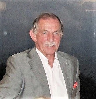
Dr Clive Fraser
Dr Clive Fraser is currently a Professorial Fellow in the Department of Infrastructure Engineering at the University of Melbourne, and a Science Advisor with FrontierSI (formerly the Cooperative Research Centre for Spatial Information). He was previously a Professor of Geomatics at the University of Melbourne, and prior to that was for 10 years Vice President of Geodetic Services, Inc. in Florida, a world-leading company in industrial photogrammetry systems and services. Prof. Fraser’s particular areas of research interest lie in digital close-range and industrial photogrammetry, and in the metric exploitation of both drone and high-resolution satellite imagery. He is a Fellow of both the Australian Academy of Technology and Engineering, and the American Society of Photogrammetry and Remote Sensing, an Honorary Fellow of SSSI and an Honorary Member of The Remote Sensing and Photogrammetric Society (UK). In recognition of his academic and professional work, which includes authorship of more than 390 scientific publications, he has earned numerous international

Dr Bruce Forster AM, FIEAust.
B.Surv., M.Surv., (Melbourne), M.Sc.,(Reading), PhD (UNSW)
Dr Forster is a former Professor and Visiting Professorial Fellow, and Director of the Centre for Remote Sensing and GIS, Faculty of Engineering, at the University of New South Wales, Sydney. He has over 40 years experience in the teaching and application of remote sensing both in Australia and internationally, and has published many papers in the field of radar remote sensing. His most recent major publication was, Forster, B.C., 2017, Microwave Imagery, Chapter 8 in Volume 1B of Earth Observation: Data, Processing and Applications. CRCSI, Melbourne. Dr Forster is the Honorary Secretary of the Remote Sensing and Photogrammetry Commission, SSSI.

Dr Dipak Paudyal
Principal Consultant (Remote Sensing & Imaging), Esri Australia
Adjunct Associate Professor, University of Queensland
Fellow: SSSI; GISP-AP, RSP Certified: SSSI
An expert in the science of remote sensing, Dipak Paudyal has over 30 years’ experience advocating real-world and practical applications of the technology within government, academia, and private industries.
Dipak is a Principal Consultant – Remote Sensing and Imaging with Esri Australia’s Solution Engineering team. He is an advocate for accelerating adoption of remote sensing in Australia. He is passionate in driving economic benefits of utilising Earth Observation by educating relevant sectors for commercial applications of the technology.
With qualifications including a PhD in remote sensing, master’s degree in natural resources management and bachelor’s degree in civil engineering, Dipak specialises in radar remote sensing, SAR Interferometry, and the application of AI in remote sensing. He has authored several research papers and blog posts on machine learning, deep learning, and AI for geospatial applications.
Dipak is also a Fellow of Surveying and Spatial Sciences Institute and is dual-certified for GIS (GISP-AP) and Remote Sensing and Photogrammetry. He also holds an adjunct associate professorship with the University of Queensland, School of Agriculture and Food Sciences.
Dipak is a Principal Consultant – Remote Sensing and Imaging with Esri Australia’s Solution Engineering team. He is an advocate for accelerating adoption of remote sensing in Australia. He is passionate in driving economic benefits of utilising Earth Observation by educating relevant sectors for commercial applications of the technology.
Dipak is also a Fellow of Surveying and Spatial Sciences Institute and is dual-certified for GIS (GISP-AP) and Remote Sensing and Photogrammetry. He also holds an adjunct associate professorship with the University of Queensland, School of Agriculture and Food Sciences.

Dr Sam Amirebrahimi
Sam is the Developer Relations and Community Relations Lead for Here Technologies in Oceania. With a technical background and over 10 years of experience in the spatial industry, Sam is passionate about marrying the power of location with other state-of-the-art technologies to design and deliver innovative solutions to address challenging needs in various sectors.


